The Lewis and Clark Expedition was a 19th-century journey commissioned by President Jefferson to explore the newly acquired Louisiana Purchase. Starting in 1804, Lewis and Clark mapped over 8,000 miles to find a water route to the Pacific Ocean. It's a thrilling true story of American exploration!
What if you were told to travel across the entire wild, unknown part of America—from the Mississippi River all the way to the Pacific Ocean—and back? Sounds like an epic video game quest, right?
Well, that’s exactly what happened over 200 years ago! In 1803, the United States bought a HUGE chunk of land called the Louisiana Purchase from France. This land doubled the size of the country! President Thomas Jefferson needed to know what was out there, so he sent two amazing explorers, Captain Meriwether Lewis and Lieutenant William Clark, to check it out. They led a group called the Corps of Discovery on an incredible journey from May 14, 1804, to September 23, 1806.

Finn says:
"Wow, Finn here! Imagine leaving your home in St. Louis, going up a massive river, crossing tall mountains, and seeing animals no one back east had ever dreamed of! Lewis and Clark had to be the toughest explorers ever to make it there and back!"
What Was the Big Mission of the Lewis and Clark Expedition?
President Jefferson had a few big jobs for Lewis and Clark and their team (which started with about 33 members, but grew to around 40!). First, they needed to find a practical water route across North America—a 'Northwest Passage'—that could connect the Mississippi River to the Pacific Ocean. This would make trading and traveling much easier!
Second, they needed to map the land! Before this trip, most maps of the West were just guesses. They had to draw accurate maps so that other Americans would know the way for future settlers.
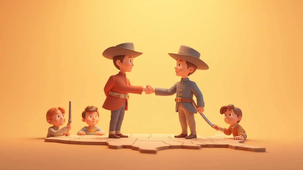
Third, they had to make friends (or at least peaceable contact) with the Native American tribes living there and learn about all the amazing new plants and animals they found. Think of it as the biggest science field trip in American history for kids!
Mind-Blowing Fact!
The explorers used special tools like a Mariner's compass, a microscope, and even mosquito curtains to help them on their 8,000-mile adventure!
How Many Miles Did the Corps of Discovery Actually Travel?
The journey was unbelievably long and tough! The group traveled by boat—using a large boat called a keelboat and smaller ones called pirogues—and by foot. They poled, pushed, and pulled their boats against strong river currents most of the way.
They spent their first winter in what is now North Dakota with the Mandan and Hidatsa tribes before continuing west in the spring of 1805. They had to cross the giant Rocky Mountains, which was one of the hardest parts of the whole trip!
(1804 to 1806)
(Round trip)
(Not known in the East!)
How Did Sacagawea Help Them Survive the Wilderness?
When the expedition was wintering over in North Dakota, a young Shoshone woman named Sacagawea joined the group with her husband and infant son. She was a superstar helper!
Sacagawea's Three Superpowers
A Token of Peace: Clark wrote that having a woman and a baby with the group immediately made Native American tribes less suspicious. A war party would never bring a woman along, so her presence showed everyone they meant peace!
Interpreter & Translator: As a Shoshone woman, she could speak to some tribes and help translate for Lewis and Clark with others. Her knowledge of languages was super important for making safe travel agreements.
Guide and Expert: When they reached the Rocky Mountains, Sacagawea recognized landmarks from her childhood! She even helped them trade for horses, which they desperately needed to cross the mountains when the rivers stopped being useful.
💡 Did You Know?
One member of the Corps of Discovery, Sergeant Charles Floyd, was the only person to die during the entire journey! He died in August 1804, likely from a burst appendix, near what is now Sioux City, Iowa.
🎯 Quick Quiz!
What was the main reason President Jefferson sent Lewis and Clark on this mission?
Why is This Expedition Still So Important Today?
Even though Lewis and Clark *didn't* find the easy all-water Northwest Passage they hoped for, their trip was a massive success!
They brought back detailed journals filled with drawings and notes about hundreds of new species of plants and animals, like the grizzly bear and prairie dog. They also created maps so accurate that they helped guide future explorers and settlers moving west.
- They documented plants like the Sugar Pine and animals like the Pronghorn antelope.
- Clark was an amazing mapmaker, creating maps that were used for decades!
- They successfully made contact with dozens of Native American nations, sharing gifts like tobacco and peace medals.
- They proved that a path *could* be made across the continent, even though it involved carrying boats over mountains!
After reaching the Pacific Ocean in November 1805, they spent a long, rainy winter at Fort Clatsop before making the return trip in 1806, finally arriving back in St. Louis a true success story of American exploration!
Questions Kids Ask About American History
Keep Exploring History!
From mapping unknown rivers to meeting new people, the Lewis and Clark Expedition was one of the most exciting adventures ever! These brave explorers showed everyone what incredible things were waiting just beyond the Mississippi River. What great discovery will *you* make next?